Trail Closure Notice – Beginning June 2, 2026
The Turkey Hill Staging Area at South Shore Camanche will be closed June 2–4, 2026, for a prescribed (Rx) burn operation. Following the closure, the staging area will reopen, and trail users may once again hike, run, or ride east toward Cooks Mesa.
The trail section west of Turkey Hill to the western terminus will remain closed until further notice for public safety.
Please respect all posted closures and signage, and check back for updates.
EBMUD carefully manages watershed lands to protect water quality be sure to have your permit with you.
How to purchase trail use permits
Permits can be purchased for $3/one day, $10/one year, $20/three years, and $30/five years. Upon request, a free trail map is included with your purchase. Trail permit holders can take members of their immediate family and 3 guests. Permits are not transferable.
- Online: Purchase and print trail use permits online.
- By mail: Download the application below and mail it with your payment to EBMUD.
- Application: email Watershed & Recreation or call 209-772-8204.
Trails
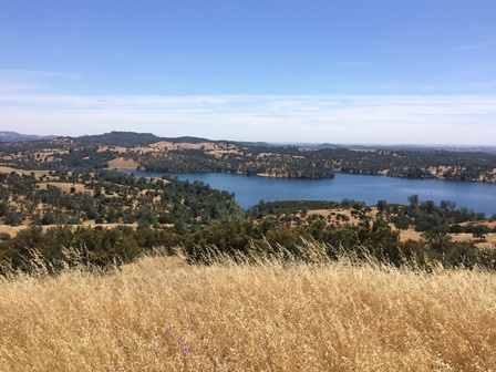
Mokelumne Coast to Crest Trail
You'll find 29 miles of continuous Mokelumne Coast to Crest Trail (MCCT) open to trail users.
-
John Bull Loop Trail:
Explore the new John Bull Trail
- Cooks Mesa Trail access point: To make day trips easier between Camanche South Shore Staging Area and the Campo Seco Staging Area, the 12.4 mile distance is divided by the Cooks Mesa Trail access point. The new trail access is 3 miles from the Camanche South Shore Staging Area, 10 miles from the Campo Seco Staging Area, and 100 yards south of the Mokelumne Watershed Headquarters on Camanche Parkway South. Cooks Mesa has drinking water, handicap-accessible chemical toilets and limited parking. Trailers are prohibited due to the small parking area.
- Patti's Point: A popular section of trail, the Patti's Point to James Bar trail is a short but steep segment of the MCCT which descends east from Patti's Point down to James Bar (off Gwin Mine Road).
- Rich Gulch Trail: For a moderate hike (4.2 miles round trip), head east from Rich Gulch to the Middle Bar Access Point. You'll follow the river canyon to the Middle Bar Bridge and pass through an area rich in history.
- Middle Bar through Independence Flat: In October 2012, EBMUD opened this last section of Mokelumne Coast to Crest Trail on District land. Since the trail alignment east of Highway 49 isn't established yet, trail users enter and exit at the Middle Bar Trail Access Point. The trail offers a loop aspect for pedestrians, following the narrow gauge along the river canyon (livestock are excluded from the canyon section for safety reasons).
When you purchase a trail permit, you may request the "Trails of the Pardee & Camanche Watersheds" map, which features the Mokelumne Coast to Crest Trail. An excerpt of the map is available below; it includes trail locations, a vicinity map and a trail guide.
Trail info on the go
Plan your trip to the Mokelumne Coast to Crest Trail using the trail map below, or download our kmz file (Google satellite) to your mobile GPS device. You may also download Google Earth to view the file. This data represents the most current digital depiction of the trail and trail features.
Events
Learn about volunteer workdays, tours and other events that EBMUD is offering directly or with other organizations. Please check back for updates.
Contact
email: recreation@ebmud.com
phone: 209-772-8204
Interested in exploring East Bay trails? EBMUD also has 90 miles of hiking and horseback-riding paths that wander through 29,000 acres of open space in the East Bay.
Resources
| Document | Type | Size |
|---|---|---|
| Mokelumne Watershed Trail Map | 5.8 MB | |
| EBMUD Trail Use Permit Application | <1 MB | |
| The Longest Mile | 1.0 MB | |
| Common Wildflowers of the Coast to Crest Trail | <1 MB | |
| Mokelumne Trail ADA Access Designations | <1 MB | |
| Mokelumne Area Map | <1 MB | |
| 2026 Trails Recreation Use Fees | <1 MB |