Trail Notifications:
Updated 07-14-2026
Partial closures, detours, and cautions:
Use caution at the Buckhorn Creek crossing on the Rocky Ridge trail.
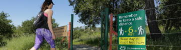
Warm weather forecasts may mean that your plans need to change to preserve health and safety for everyone in your group. Know before you start out; plan ahead.
The National Weather Service advisory page for our area is https://www.weather.gov/mtr/
Virtual tour of best Bay Area hikes
Take a virtual tour of some of EBMUD Rangers' favorite hikes for inspiration for your next adventure. You will redirect off of ebmud.com. Must use Google Chrome or Microsoft Edge.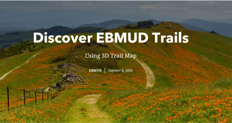
Interactive trails maps
EBMUD is pleased to provide an update to our East Bay trails maps, a new interactive 3-D version, and updated printable versions.
Using Geographic Information System mapping technology, this 3-dimensional experience offers detailed trail locations, access points, elevations, amenities and a search function that allows you to find your ideal trails, whether you are an endurance runner looking for your next challenge, or a pet parent in search of a dog-friendly stroll.
We'd love to hear what you love. Share photos and review of your favorite #ebmudtrails on Facebook and X.
Watch the video below to learn how to use the new interactive map.

Printable maps
Overview and key
View the entire East Bay trails system, and the map key to learn what our symbols mean.

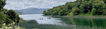
Lafayette Reservoir
Check out the Lakeside Nature Trail and all connecting trails at Lafayette Reservoir.
North Watershed
This Printable pdf map shows the North Watershed trails system around San Pablo and Briones reservoirs.
South Watershed
This printable pdf map shows the South Watershed trails system around Upper San Leandro and Chabot reservoirs.
Permits and trail maintenance

Trail Use Permits
Permits are required at all times on EBMUD trails; you can purchase a permit online.

Report a trail problem
Whether it's a fallen tree or a patch of eroded earth, we want to know about it. Report trail problems here.
Contact
EBMUD: Recreation@ebmud.com
Police: East Bay Regional Park Police 24-hour dispatch 510-881-1833.
Emergency: 9-1-1
More resources
| Document | Type | Size |
|---|---|---|
| Trail Use Permit Application | <1 MB | |
| 2026 Trails Recreation Use Fees | <1 MB | |
| Eagles Nest Multi-Use/Bike Trail | 1.2 MB | |
| Pinole Valley Multi-Use/Bike Trail | 1.8 MB | |
| Watershed Rules and Regulations | <1 MB |